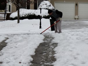
I live in the Atlanta area, and so I have been snowed/iced in for the past week. The daily sledding has been great. No trash pick-up? Not so much. It started Sunday night as beautiful, large snowflakes fell, making everything around us white and quiet. It was glorious. People in the south react strangely to snow, as evidenced by the neighborhood teenagers snowboarding down the street at midnight. The next morning we had freezing rain, resulting in a sheet of ice on top of 5 inches of snow. Let me remind you that Atlanta has a total of 10 trucks to salt and plow all of metro Atlanta. So just about every road was covered in ice, and temperatures remained below freezing all week.
With the mixture of snow and ice on the ground, I wondered why the precipitation changed given that it was never above freezing during the storm. I did a little research and found that it all has to do with the “atmospheric profile”. In other words, how the depth and temperature of each layer of air can transform the precipitation from its origination point until it hits the ground.
Here is a brief description of each type of precipitation, followed by a great diagram to help explain:
SNOW: Atmospheric profile is entirely below freezing, precipitation begins and falls as snow.
SLEET: Begins as snow but it passes through a layer of air that is above freezing. The snow partially melts at this point, but then re-freezes into ice pellets as it enters a layer of air below freezing before it hits the ground.
FREEZING RAIN: Begins as snow or rain then passes through a deep layer of air that is above freezing. The layer of air at ground-level is below freezing, but because the layer of air is shallow, the precipitation does not have time to freeze. Instead the rain freezes on contact with whatever it hits on the ground.
ATMOSPHERIC PROFILE FOR SNOW
ATMOSPHERIC PROFILE FOR SLEET
ATMOSPHERIC PROFILE POR FREEZING RAIN
That explains the mess on the ground. Now we just need a way to quickly clean it up. Please, please, please trash men come today!!!


